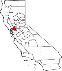
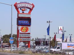
Fairfield, California
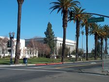
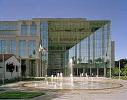
West Texas Street in Downtown
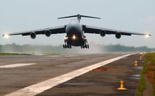
Military C-5 Aircraft from Travis Air Force Base takes off in Sierra Leone
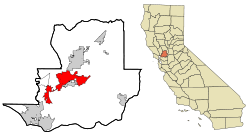
Fairfield is a city located in the northeastern portion of the San Francisco Bay Area in Northern California, USA (See East Bay and North Bay). It is approximately 40 miles (64 km) from both the city of San Francisco and the city of Sacramento, approximately 39 miles (63 km) from Oakland, less than 18 miles (29 km) from Napa Valley , 15 miles from the Carquinez Bridge, and 13 miles from the Benicia Bridge. Fairfield was founded in 1859 by clippership captain Robert H. Waterman, and named after his former hometown of Fairfield, Connecticut. It is the home of Travis Air Force Base and the Jelly Belly jelly bean factory, and has a population of almost 108,000; slightly less than Vallejo, which is the Bay Area's ninth-largest city.[1] It shares a border with its sister city, Suisun City. Other nearby cities include Vacaville, Benicia, Napa and Vallejo. Fairfield is the county seat of Solano County.
Geography
Fairfield is located at 38°15'28" North, 122°3'15" West (38.257763, -122.054256).[2]
According to the United States Census Bureau, the city has a total area of 38.7 square miles (102.623 km²), of which, 37.7 square miles (98.5 km²) of it is land and 4.04 square miles (3.1 km²) of it is water. The total area is 5.95% water.
The city is located within the California Coastal Ranges of the San Francisco Bay Area. The city is centered directly north of the Suisun Bay and northeast of the San Pablo Bay. Much of the Suisun Bay contains the Suisun Marsh, the largest saltwater marsh on the west coast of the United States. The Sacramento Valley lies east of Fairfield.
History
The history of Fairfield stretches back five to six thousand years. That is the age of artifacts of native people which have been excavated here. The first European contact came in 1810 when the Spanish army was ordered to attack the Suisin Indians. In 1835 the Mexican General Vallejo was so magnanimous in victory over the Indian Chief Sem Yeto that the chief later became his ally in conflicts against other tribes. In 1837 the Indian Chief Solano received the Rancho Suisun Mexican land grant. This grant eventually came into the hands of a clipper ship captain from Connecticut named Robert H. Waterman. He not only parceled out the town in 1856, but also, in a commercially shrewd move, arranged to have the county seat moved here in 1858 from Benicia. As an inducement he granted 16 acres (65,000 m2) of land for the construction of county buildings. In 1903 Fairfield was incorporated as a city.
Demographics
As of the census[3] of 2000, there are 106,521 people, 33,494 households, and 24,016 families residing in the city. The population density is 2,782 people per square mile. The racial makeup of the city is 46.54% White, 19.08% Black or African American, 0.73% Native American, 12.53% Asian, 0.93% Pacific Islander, 8.77% from other races, and 7.41% from two or more races. 24.48% of the population are Hispanic or Latino of any race.
There are 33,494 households out of which 43.1% have children under the age of 18 living with them, 58.4% are married couples living together, 14.2% have a female householder with no husband present, and 22.2% are non-families. 17.0% of all households are made up of individuals and 5.5% have someone living alone who is 65 years of age or older. The average household size is 2.98 and the average family size is 3.33.
In the city the population is spread out with 29.8% under the age of 18, 11.1% from 18 to 24, 31.3% from 25 to 44, 18.8% from 45 to 64, and 9.0% who are 65 years of age or older. The median age is 31 years. For every 100 females there are 99.1 males. For every 100 females age 18 and over, there are 97.4 males.
The median income for a household in the city is $49,151, and the median income for a family is $52,503. Males have a median income of $35,544 versus $27,616 for females. The per capita income for the city is $18,617. 13.1% of the population and 8.9% of families are below the poverty line. Out of the total population, 14.1% of those under the age of 18 and 7.2% of those 65 and older are living below the poverty line.
Industry and major employers
Fairfield has a diversified economy, with government, manufacturing, health care, retail, professional and commercial construction sectors.[4] Anheuser-Busch operates a large Budweiser brewery facility, Clorox produces bleach products, and the Jelly Belly Candy Company confects its specialty jelly beans in Fairfield.[4]
Schools
Fairfield's public schools belong to the Fairfield-Suisun Unified School District; (FSUSD) and the Travis Unified School District; (TAFBUSD).
Area High Schools
Area Middle Schools (FSUSD)
(Some middle schools will be closed)
- Sem Yeto Continuation School and Mary Bird Community Day School are part of the FSUSD. Vanden High School is part of the TUSD, and is located near Travis Air Force Base. All others are part of the FSUSD.
Universities nearby include California Maritime Academy, UC Davis, UC Berkeley, Sacramento State, CSU East Bay, Sonoma State, Trinity College of Massage, St. Mary's College, University of Phoenix, and Chapman University[5]. The main campus of Solano Community College is located in Fairfield.
Recreation

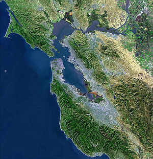
Aerial view of Fairfield, with Travis Air Force Base in the upper center.
Parks
- Rockville Hills Regional Park
- The Park is located on Rockville Road approximately 3/4 of a mile from the corner of Suisun Valley and Rockville Roads. Allows bicycling, hiking, and provides walking trails.
- Fairfield Linear Park
- The Linear Park stretches through the city along a former railroad right-of-way. Picnic tables and play equipment can be found along the route. Runners, walkers, and bicyclists enjoy this park.
- Alan Witt Park
- Contains a brand new Aquatics Complex, the Fairfield Sports Center, and Fairfield-Suisun Rotary Skate Park. The new Aquatics Complex includes water slides, toddler play area, youth play pool, lap swimming, indoor activity pool, and a "lazy river" current for water walking or floating. The park also offers tennis courts, a recreation building, picnic area, ball fields, basketball courts, volleyball courts, a skate park, and horse shoe pits. Restroom facilities are available.
Golf courses
- Fairfield is home to three golf courses, two public and one private. Paradise Valley and Rancho Solano Golf Courses, both public, are rated in the Zagat Survey of “America’s Best Golf Courses,” rated 3 ½ stars by Golf Digest Magazine in 2004 and voted #1 & #2 golf courses in Solano County for consecutive years.
Sister cities
References
External links
|
San Francisco Bay Area |
|
| Bodies of water |
Bodega Bay · Carquinez Strait · Clifton Forebay · Golden Gate · Grizzly Bay · Guadalupe River · Half Moon Bay · Lake Berryessa · Napa River · Oakland Estuary · Petaluma River · Richardson Bay · Richmond Inner Harbor · Russian River · San Francisco Bay · San Leandro Bay · San Pablo Bay · Sonoma Creek · Suisun Bay · Tomales Bay
|
 |
|
| Counties |
|
|
| Major cities |
|
|
Cities and towns
100k-250k |
|
|
Cities and towns
25k-99k |
|
|
Cities and towns
10k-25k |
Alamo · Albany · Alum Rock · Ashland · Bay Point · Blackhawk-Camino Tassajara · Brentwood · Cherryland · Clayton · Dixon · El Cerrito · El Sobrante · Half Moon Bay · Healdsburg · Hercules · Hillsborough · Lafayette · Larkspur · Millbrae · Mill Valley · Moraga · North Fair Oaks · Orinda · Piedmont · Pinole · San Anselmo · San Lorenzo · Stanford · Tamalpais-Homestead Valley · Windsor
|
|
| Sub-regions |
|
|
|
Municipalities and communities of Solano County, California |
|
| County seat: Fairfield |
|
| Cities |
Benicia | Dixon | Fairfield | Rio Vista | Suisun City | Vacaville | Vallejo
|
|
|
| CDPs |
|
|
Unincorporated
communities |
Allendale | Bahia | Batavia | Birds Landing | Bucktown | Collinsville | Rockville | Yolano
|
|
 State of California State of California |
|
| Sacramento (capital) |
|
| Topics |
Climate · Delegations · Deserts · Districts · Ecology · Elections · Geography · Government · History · Protected areas · Sports · Symbols · Transportation · Visitor attractions · Index of California-related articles
|
|
| Society |
Californians · Culture · Crime · Demographics · Economy · Education · Politics
|
|
| Regions |
|
|
| Metro areas |
|
|
| Micro areas |
Bishop · Clearlake · Crescent City · Eureka–Arcata–Fortuna · Phoenix Lake-Cedar Ridge · Red Bluff · Susanville · Truckee–Grass Valley · Ukiah
|
|
| Counties |
|
|
 |
|
|
Vacaville |
|
| Napa |
 |
Travis AFB |
 Fairfield Fairfield  |
 |
| Vallejo |
Benicia • Suisun City |
Rio Vista |

 Nirasaki, Japan